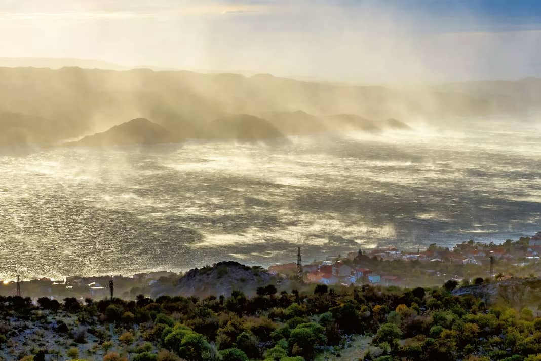
Bora is like a woman, as the old Croatian saying goes. Unpredictable, but visually a blessing. The Slovenian-Croatian Adriatic coast is free of the usual haze during the bora, and there is usually even a bright blue sky over the coastal region, which can make the most of its scenic charms in this weather.
This wind takes some getting used to. Like the Mistral, it is an offshore, relatively cool and fairly lively wind. In terms of direction and strength, this east to north-easterly is very capricious, indeed, in this respect it surpasses its French counterpart by far. As a sudden downslope wind, it rushes onto the Adriatic coast and conquers the spots from one moment to the next. Locals refer to the bora as an attack from the hinterland.
The best bora spots in Croatia
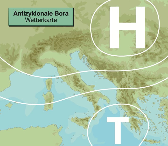
Typical weather map
A previous cold air intrusion into the north of the Balkans causes the air pressure there to rise. At the same time, the air pressure over southern Italy is relatively low. This results in a wind shift to the east to north-east on the east coast of the Adriatic: the bora develops. The easterly winds are jet-like accelerated by passes in the Dinaric Mountains on their way to the coast. At the same time, the slopes of the coastal mountains towards the Adriatic act like ramps on which the cold air - heavy for physical reasons - falls down to the sea. The result of this unholy alliance of air pressure distribution and topography are violent downbursts that hit the coastal region like a storm.
In this situation between high and low pressure, high pressure prevails on the Slovenian-Croatian coast, especially in summer. In addition, the descending air movement based on the foehn principle disperses many clouds.
Bora - the cold beauty
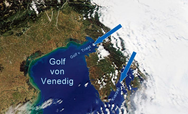
The prerequisite for a strong bora is an area of high pressure over the northern Balkans, with low pressure over the Ionian Sea. Then the well-known bora jets are firing and the satellite image shows a typical cloud pattern.

Area of action
The Bora's area of influence extends from the Gulf of Trieste in the north down to southern Dalmatia, around the height of Dubrovnik. In contrast to most other winds in the Mediterranean region, the gusty bora affects the coastal areas with very different strengths. Fortunately, it is always the same zones where the bora rages particularly fiercely. The locals know them very well. The most feared bora tracks are often east-west or north-east-south-west orientated valleys that end at the coast - or narrow sea lanes with a similar orientation (jet or guide effect). The Gulf of Rijeka with the Kvarner strait to the east of Istria is one of the most notorious bora jets - probably the most popular with hard-core surfers. Or the Velebitski Channel between the east coast of the island of Rab and the coastal town of Jablanac.
High season
Bora outbreaks are possible all year round - from May to September, however, they tend to be less frequent, of shorter duration and also less severe than in the winter months. From May to August, an episode of bora usually lasts no longer than one to three days. In winter, on the other hand, six to seven days of stormy bora and temporary gale-force winds are not uncommon. Shipping traffic then comes to a standstill in the bora lanes and some Dalmatian islands are cut off from the outside world.
Typical wind and weather conditions
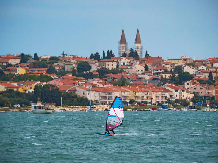
During the bora it is relatively cool and the visibility is exhilaratingly clear. A distinction is made between a bad weather bora and a bora with sunshine until the sun goes down. The cloudy bora (cyclonic bora, bora chiura) is most likely to occur in the winter months, but there is hardly any rain. The fair-weather bora (anticyclonic bora, bora sciara), on the other hand, is typical of the warm season. However, it doesn't get really warm at midday and in the afternoon either; you can feel the cold origin of the air mass. The wind blows strongest on the first day of the bora outbreak and then becomes weaker day by day. Four to six Beaufort are characteristic of the summer Bora, a weak Bora is also called Borino. In winter, on the other hand, the wind is feared as Boraccia - force seven to nine is typical and the gusts are called Reffoli. Particularly violent bora storms are often associated with gale-force gusts.
Amplification factors
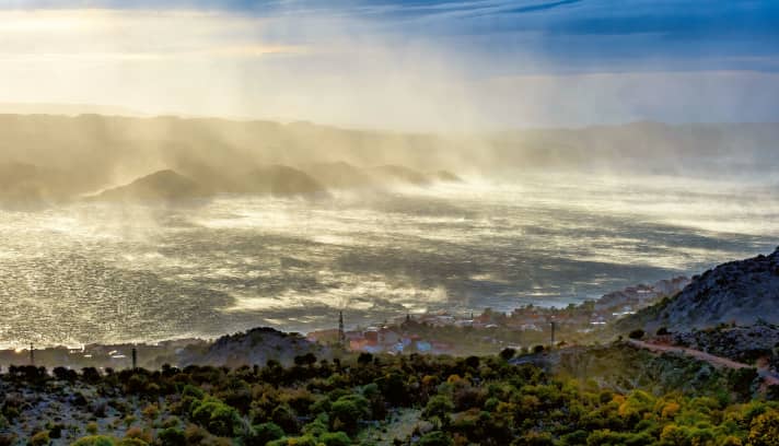
The bora is particularly strong when the cold snap in the Balkans, which initiates this Adriatic wind, is particularly intense. From November to April, it is often accompanied by snow and ice beyond the Dalmatian mountains. A strong to stormy bora can also be triggered by a powerful low over central or southern Italy - especially if its core pressure drops below 1000 hectopascals. Finally, there are the aforementioned local jet, crash barrier and cape effects, due to the rich topographical structure of the Dalmatian coastline. It can happen that the wind here is blowing at four to five Beaufort, and a kilometre further on a Bora of force six to eight - with gusts of nine - is roaring over the spot. You can recognise such bora tracks by the spray on the water, the fumarea.
Disruptive factors
Persistently rising air pressure from the western Mediterranean is depriving the bora of its basis for existence, which consists of a constellation of high pressure over the Balkans and low pressure over the Adriatic. Falling air pressure over the Alpine region including the Balkans also heralds the imminent end of the Adriatic downdraft. Rising temperatures from day to day are also a sign that the hours or days of the bora are numbered at the spots. The bora is usually strongest at night and in the morning. With the usual daytime warming, the bora gets a counterpart in the form of the thermal sea breeze effect. This is not necessarily able to stop or even reverse the offshore downslope wind. But it does at least weaken it from midday to the evening - especially in the summer months.
All parts of the wind special:
- The west wind
- The east wind on the Baltic Sea
- Ora and Vento on Lake Garda
- The foehn in the Alps
- The Meltemi in Greece
- The bora in Croatia
- The sirocco in the central Mediterranean
- The mistral in the south of France
- The Tramontana in the northern Mediterranean
- The Levante in southern Spain
- The trade wind zone
- The roots of the trade winds
- Core trade wind - In the centre of the trade wind
- Passat run-off zone - The end of the Passat
- Interview: Climate researcher Dr Michael Sachweh - "Chasing storms is my passion"
- Windfinder: How wind forecasts are created, the difference between forecast and super-forecast
