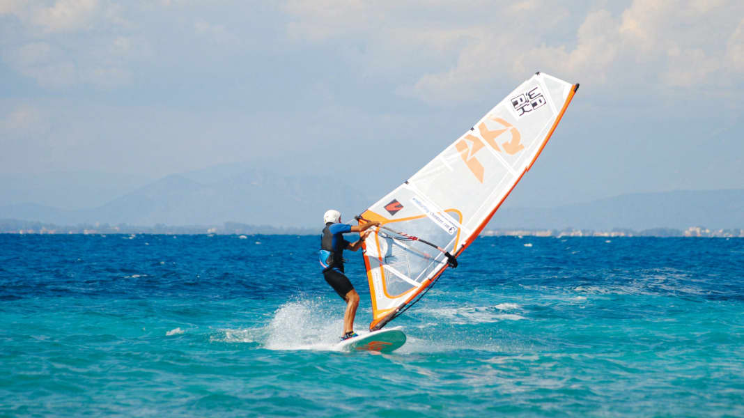
The origin of the word comes from Arabic: sherki means south-east wind. In Italian it became scirocco, the Croats call it jugo and we speak of sirocco. Sometimes it blows directly from the south, in which case it is called Ostro.
Although sirocco weather conditions can occur throughout the Mediterranean, this southerly air current is most frequently observed in the waters around Italy.
Spots with sirocco:
This wind is the complete opposite of the bora. While the latter is a brazen attack from the hinterland, often blows strongest at the beginning and keeps us on our toes with its extreme gusts (all this in sunshine and crystal-clear air), the sirocco's temperament clearly tends towards phlegmatism. It doesn't come as a brazen attack, but sneaks into the spots almost imperceptibly through the back door: on the first day it's no more than a whiff, on the second a weak breeze, on the third it gradually comes to life. Visibility is extremely poor. If the sails seem close enough to touch far out in the bora, they look like a distant mirage in the haze of the sirocco.
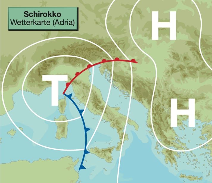
Typical weather map
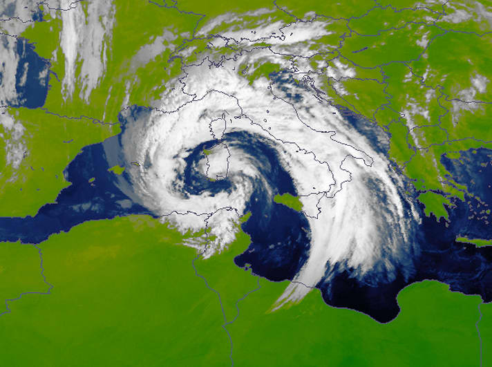
The sirocco occurs particularly often in the Adriatic. The typical air pressure distribution that sets this southerly flow in motion is low air pressure over the western Mediterranean, the foothills of which sometimes reach as far as the Adriatic. Opposite in the Balkans, the air pressure is high, sometimes with a wedge extending into the eastern Mediterranean. With this air pressure distribution, warm air from the southern Mediterranean reaches the Italian, Dalmatian and western Greek spots in the Ionian Sea.
In summer, the influence of low pressure is only slightly pronounced, with high pressure usually determining the weather. From autumn to spring, on the other hand, changeable low-pressure weather dominates, especially on the Italian beaches.
Area of action
Sirocco and sirocco-like weather conditions are possible anywhere in the Mediterranean - from the spots on the Costa del Sol in the west to the coasts of Turkey and Cyprus. The main thing is that the classic pressure constellation develops: a low in the west and a high in the east. The low is the driving force behind the formation of the sirocco, on whose eastern flank the southerly winds are generated.
Mediterranean lows feel particularly at home in the sea areas between the Balearic Islands, the Ligurian coast and the Tyrrhenian Sea. For this reason, the southerly wind often does the honours east of the low pressure cores, along the coasts of Italy over to Dalmatia and down to the Ionian spots such as Lefkas.
High season
Sirocco is possible all year round, especially from autumn to spring, with a slight lead in the frequency and wind force statistics in the early season. Depending on the season and region, it occurs with a probability of ten to 20 per cent. It is therefore an episodic phenomenon - the only characteristic it has in common with the bora.
The sirocco usually blows for two to three, maximum four days. Initially only a breeze, it then increases from day to day. In contrast to the strong winds and storms of the mistral and the bora, the sirocco usually remains a peaceful wind until the end, rarely exceeding five Beaufort.
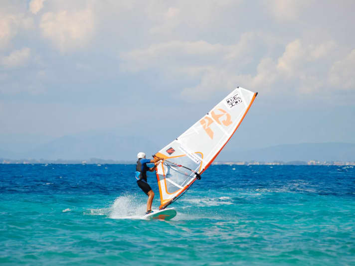
Typical wind and weather conditions
From October to May, it is pleasantly warm in Sirocco thanks to the southern origin of the air masses. From June to September, the pleasant warmth turns into a rather oppressive sultriness. Especially at the beginning of this weather period, when the sun is usually still shining - and the weak breeze offers no significant wind chill.
In the course of a sirocco period, the cloud cover slowly increases and loose cloud fields move across the sky again and again. Towards the end, the clouds thicken. In summer, improved visibility and a change in wind direction to westerly directions herald the end of the sirocco. From the end of September to the beginning of May, however, the south wind often ends with rainfall. Sometimes it is a brilliant finale with heavy showers and thunderstorms. And temporarily even with strong gusts of wind or squalls - but strictly speaking, these gusts are no longer part of the sirocco. They come in from the south-west to west and practically give our southerly wind the boot.
Otherwise, typical sirocco wind forces at the beginning of this weather situation are one to two, later three to four Beaufort from south-east to south. A pronounced sirocco weather situation can sometimes reach force five on exposed coasts and towards the end.
A hallmark of this wind is the heavy haze. The further north in the Mediterranean, the greater the reduction in visibility. The poor visibility is not only due to the humid haze, but the air current is often also mixed with a North African present: Saharan dust.
While surfers can look forward to relatively smooth water with the mistral - which is offshore on many beaches - and also with the bora, the sea is higher with the sirocco. The longer the distance the air current affects the sea and the greater the so-called fetch, the higher the waves. This is why prolonged sirocco weather conditions in the northern Mediterranean region cause rough seas. In addition, the water levels in the harbours rise, and the lagoon city of Venice always has its notorious high tides (agua alta) during sirocco.
Amplification factors
The stronger the low (in contrast to the Atlantic lows, a core pressure of less than 1000 hPa in the Mediterranean is already remarkable) and the stronger the high in the east, the more lively the sirocco blows.
There are also topographical effects on some coasts that act as a speed factor for the southerly wind. This is the case, for example, in the Strait of Messina between Sicily and Calabria and at its northern exit, where a funnel effect gives the south an extra kick. In this north-south orientated strait, the wind often blows at six to eight Beaufort in sirocco conditions. The guard rail effect off the Gargano peninsula in the Adriatic has a similar effect. The locals here know that with southerly winds, one to two wind forces are added to the strengths predicted in the weather forecast - due to the topography. The sirocco often freshens up to five to seven Beaufort at this point.
It is typical of the sirocco that it gets stronger from day to day. The air becomes increasingly hazy.
Disruptive factors
The low in the western Mediterranean is the most important foundation of the sirocco. If it moves further towards the eastern Mediterranean (or if it gradually weakens and falls to its knees completely), the days or hours of the south wind at the spot are also numbered. The change in the weather can be recognised by the wind shifting to a westerly direction. At the same time, visibility improves significantly. Persistently rising air pressure is another sign of the end of a sirocco period.
Sirocco - slightly hazy
The low-pressure vortex over the Adriatic shovels warm and humid air into the north on its eastern flank. It is often mixed with Saharan dust. In contrast to the sudden onset of the bora, the sirocco tends to sneak up on us quietly.
All parts of the wind special:
- The west wind
- The east wind on the Baltic Sea
- Ora and Vento on Lake Garda
- The foehn in the Alps
- The Meltemi in Greece
- The bora in Croatia
- The sirocco in the central Mediterranean
- The mistral in the south of France
- The Tramontana in the northern Mediterranean
- The Levante in southern Spain
- The trade wind zone
- The roots of the trade winds
- Core trade wind - In the centre of the trade wind
- Passat run-off zone - The end of the Passat
- Interview: Climate researcher Dr Michael Sachweh - "Chasing storms is my passion"
- Windfinder: How wind forecasts are created, the difference between forecast and super-forecast
