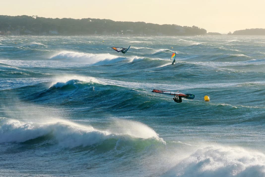
What would you say if someone claimed that one of the stormiest spots on earth was in the Mediterranean? Probably something like: "What did you take?" But it's true. The French coastal section of the Mediterranean between the Pyrenees and the Maritime Alps has it all in terms of wind, and is even on a par with Cape Horn in terms of storm frequency.
But only in certain weather conditions - and unlike the infamous Cape, only in those where the wind blows offshore and the sun shines.
Spots with Mistral:
This wind is called mistral. It was named after the Latin "ventus magistralis", which means "ruler's wind". Nomen est omen, because this north-westerly wind, which often blows as a strong wind or storm, dominates the entire Lion's Gulf coast - at least occasionally. When it rages, everyone seeks shelter. Almost everyone: if you visit the deserted beaches on mistral days, you will meet the lucky strong wind surfers.
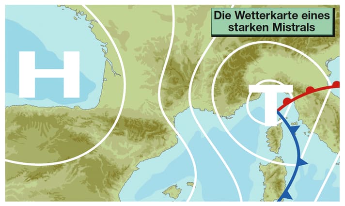
Typical weather map
A high pressure system determines the weather situation in the northern Spain-Biskaya-West France region. In contrast, the air pressure is relatively low in northern Italy including the Ligurian Sea. The resulting air pressure gradient between the two opposing players is centred on the coastal part of the Mediterranean south of France, including the Gulf of Lions. This allows air masses from western, central or northern Europe to reach the north-western Mediterranean via France at an accelerated rate. Jet effects at the exit of the Rhône Valley between the Maritime Alps and the Massif Central (or in the part of the Garonne-Carcassonne depression near the Mediterranean between the Massif Central and the Pyrenees) as well as downdraughts on the seaward side of the mountains) provide an additional speed factor.
Area of action
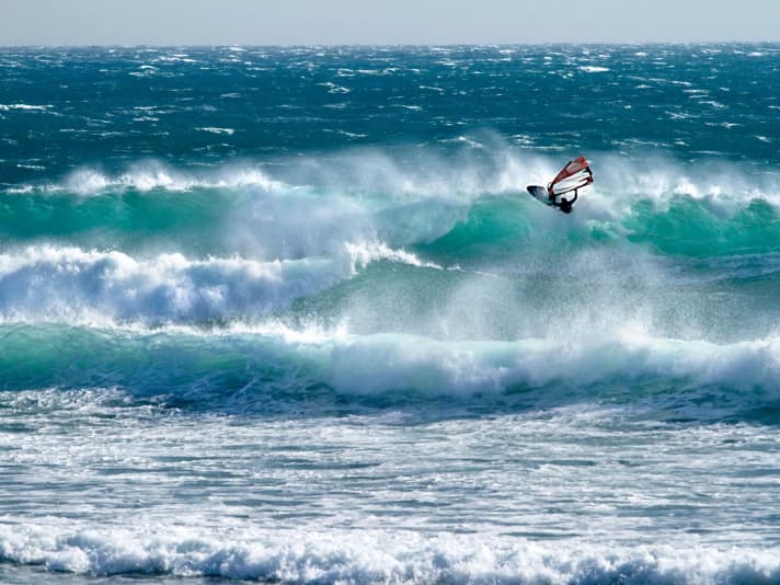
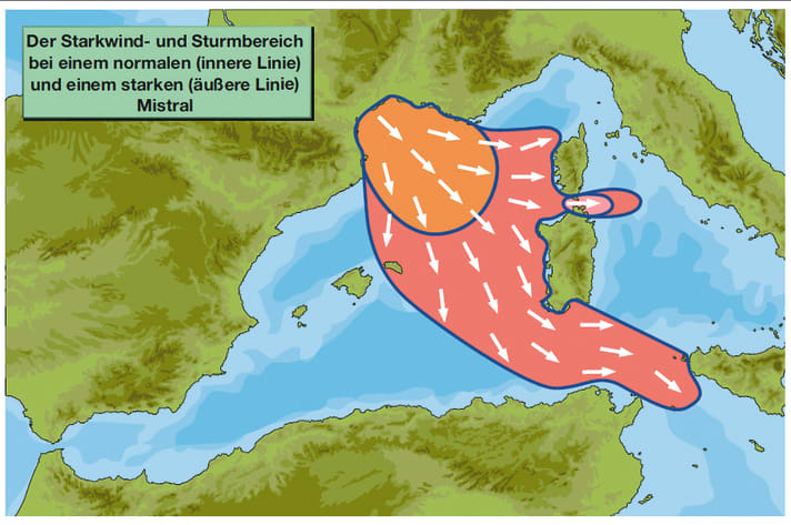
The entire stretch of coast from the beaches of Perpignan in the west to the bay of Toulon in the east is affected by the mistral. A strong mistral can stir up the entire Gulf of Lions and reaches as far as Corsica and Sardinia. There, the high swell on the west coasts makes even the strong-wind surfers look sad - but their faces brighten up again in the strait between Corsica and Sardinia. This is because the jet effect in the Strait of Bonifacio acts like a rejuvenating cure for the mistral - and so the strong north-westerly wind turns into a full-blown westerly gale on the way into the narrows between the capes of the two islands.
The mistral is a tough bugger, often icy cold and brutal as it descends on the southern French coast.
High season
The Mistral blows strongest in the winter months. It almost always brings heavy squalls with it, and surfers are also not safe from gale-force gusts due to localised corner and jet effects. But even in September and May, you are not safe from heavy squalls in pronounced mistral weather conditions.
From June to August, it is easier to care for and blows moderately to strongly, often with four to six Beaufort. A mistral episode then rarely lasts longer than one to three days.
Typical weather and wind conditions
The wind is blowing at four to six, gusting to seven Beaufort from west-northwest to north-northwest. It is extremely gusty close to the coast. Especially in summer, it weakens a little at midday and in the afternoon, with the strongest gusts at night and in the morning.
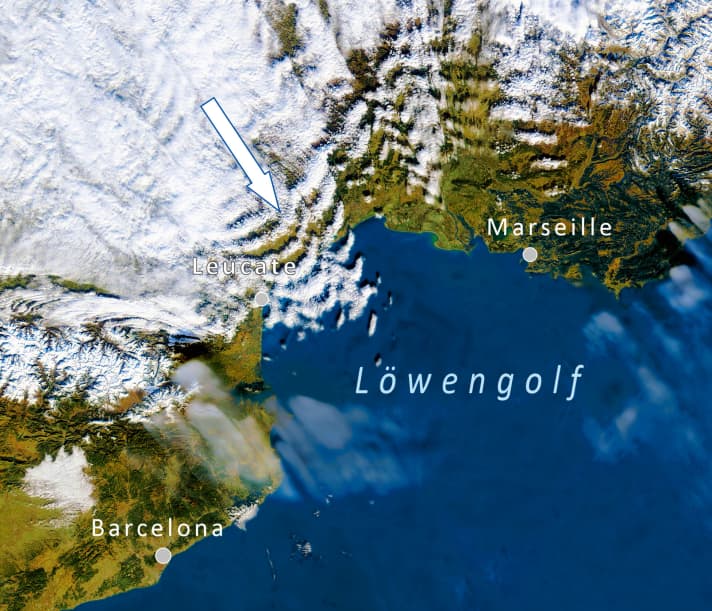
A few patches of cloud pass through at first. Later it is very sunny. At the same time, the atmosphere is very transparent, which makes for stunning visibility and a bright blue sky. Towards the east, in the direction of the Côte d'Azur and the Ligurian Sea, there is often a sharp boundary to cloudy or at least very hazy weather. It is relatively warm at midday and in the afternoon in summer, otherwise rather cool.
Amplification factors
In a mistral weather situation, the air pressure over the Ligurian Sea is relatively low. If the drop in air pressure there intensifies to such an extent that an independent low develops over the Gulf of Genoa, this gives the mistral a powerful kick - the strong wind becomes a storm. At the same time, its area of control expands considerably beyond the Gulf of Lions. All of a sudden, Menorca is fully caught in the mistral jet, and Corsica's and Sardinia's west coasts are pounded by powerful surf. Downwind of the islands you are not safe from squalls, and the north-east of Corsica around Bastia is particularly notorious for squalls in mistral conditions. In the Strait of Bonifacio, the strait between the two islands, there is a severe storm or even a hurricane in strong mistral weather - but with a calm and therefore surfable swell!

Disruptive factors
Any change in the general weather situation that leads to rising air pressure over the Ligurian Sea weakens the mistral. The same applies to the other air pressure foundation of the mistral: if the western European high weakens, for example because an Atlantic low is approaching, the northwest runs out of steam.
In addition, a weak mistral tends to give way to the thermally induced, onshore sea breeze (generated by warmed land and cool sea) at midday and in the afternoon. This rarely happens on the first day of a mistral outbreak, more often on the second or third day.
Special features
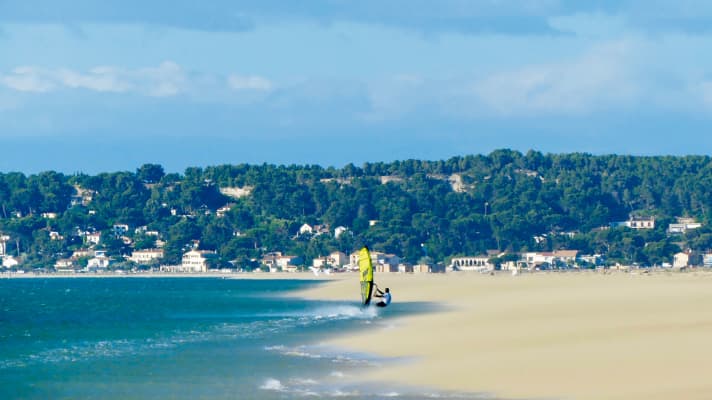
The normal mistral is a north-westerly to northerly current, with the Rhône valley acting as the main jet. Sometimes the air pressure distribution ensures that the air flow has a greater westerly than northerly component. In this case, the main jet changes from the Rhône valley to the Garonne-Carcassonne depression (between the Pyrenees and the Massif Central). A strong mistral from the west to north-west then sweeps over the entire west coast of the Gulf - also known as Caers there - from the beaches of Narbonne in the north to south of Perpignan in the south. To the delight of the locals around Leucate, where new speed windsurfing records are regularly set. The La Palme spot, north of Leucate, is the venue for the Prince of Speed.
The Mistral delights both wave freaks and speed riders. The Ètangs also attract freeriders.
The Mistral fan
An area of high pressure over the Bay of Biscay and low pressure over the Ligurian Sea give rise to the mistral. The Rhone Valley and Garonne-Carcassone depression strengthen the wind, which can reach far into the Mediterranean. What many windsurfers love has already been the undoing of numerous recreational skippers.
All parts of the wind special:
- The west wind
- The east wind on the Baltic Sea
- Ora and Vento on Lake Garda
- The foehn in the Alps
- The Meltemi in Greece
- The bora in Croatia
- The sirocco in the central Mediterranean
- The mistral in the south of France
- The Tramontana in the northern Mediterranean
- The Levante in southern Spain
- The trade wind zone
- The roots of the trade winds
- Core trade wind - In the centre of the trade wind
- Passat run-off zone - The end of the Passat
- Interview: Climate researcher Dr Michael Sachweh - "Chasing storms is my passion"
- Windfinder: How wind forecasts are created, the difference between forecast and super-forecast
