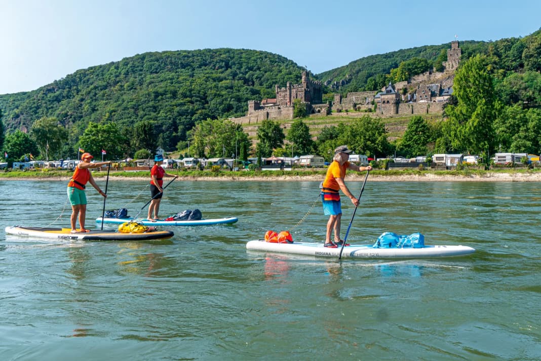
Long, heavy goods ships, large river cruise ships, small excursion steamers and fast private boats - there is a lot going on on the Rhine, and not just between Bingen and Koblenz. And five stand-up paddlers in between. Before the start of the tour, you start to think: How will it be on the busiest inland waterway in Europe? How dangerously close will the big boats get? Will the captains of the barges see us? How will we get through the narrow section at the famous Loreley? On the two-day tour through the Upper Middle Rhine Valley, which as a UNESCO World Heritage Site is often described as the most beautiful section of the Rhine, we will find out.
Over 40 fortresses, castles and ruins, traditional viticulture, idyllic places and a tricky bottleneck: the Upper Middle Rhine Valley is the perfect setting for an exciting two-day SUP tour, where enjoying the legendary landscape can take centre stage? Or does it promise pure adrenalin on narrow boards?


We set up our base in a holiday flat in St. Goar. To get us in the mood, we treat ourselves to a flood wine from the Ahr - from the distinctive muddy bottle - and toast to hopefully two wonderful days on and off the water.
The next morning, the train takes us to the start in Bingen in just 25 minutes. A small basin below the old harbour crane from 1487 provides a perfect start to the 28-kilometre stage to St. Goar. On the meadow above, we pump up our touring boards, lash our equipment to the SUPs and head out onto the water.
Legends, sagas and history - a new story awaits us on every kilometre of the Middle Rhine Valley.
We take a brief look at the Niederwald monument, but then have to concentrate on the open Rhine. Because we are immediately in the middle of the shipping traffic: numerous excursion steamers dock and depart in Bingen, goods ships fight their way upstream and small private boats speed past us. We have to cross the carriageway straight away. The first challenge comes sooner than expected! On the left bank of the Rhine, shallows, gravel banks, small riverbed ramps and a dangerous underwater weir make it impossible to cross.
The river is easy to survey for around 2 kilometres. Judging the speed of the boats correctly, keeping an eye on the current, assessing the situation safely - not so easy! We take advantage of a good opportunity with no shipping traffic and paddle to the right-hand side of the river up to the red buoys that mark the channel.
For the entire tour, you should always paddle (where available) along the left (green) or right (red) buoys and thus at the edge of the fairway. It is deep enough there, there are no danger spots and you are not paddling in the path of the ships. If you have little experience in flowing water and on shipping lanes, you will quickly be overwhelmed here. With the ships, the current, the right behaviour, the rules. According to paragraph 4 of the Rhine Police Regulations, small vessels such as SUPs must carry a sound device in the form of a horn or horn on the Rhine.
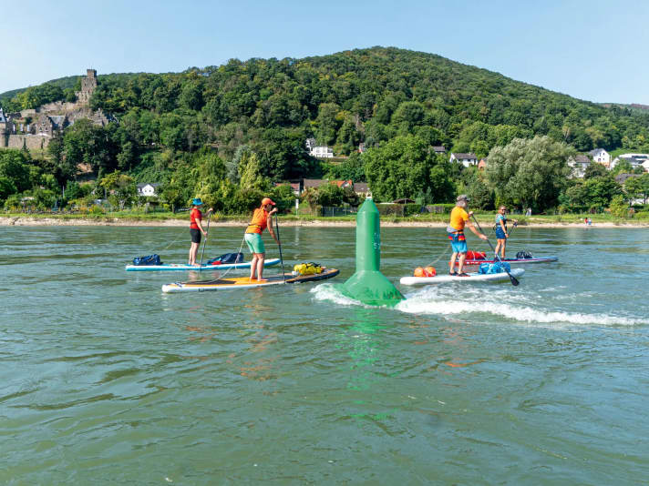
We paddle towards the Mäuseturm tower, which was built around 1300 as a watchtower. Opposite is the ruins of Ehrenfels Castle, which in the 17th century was still a stately home and customs centre. Behind the two sights, a rock face crosses the river, which once caused a waterfall and made it difficult to get through. At the "Binger Loch", the current increases significantly once again. Here the Rhine bends from its course westwards towards the north - the Middle Rhine Valley begins.
At Rheinstein Castle, we cross the fairway again to the left side of the river. A large container ship quickly approaches from behind. We pick up speed and reach the other side of the river in good time. And the transport ship is right next to us. We make sure we keep enough distance to the side so that we don't get caught in the wake. And we also master the waves. Thanks to the current of 7 to 10 km/h, we make rapid progress without much effort, paddling past Trechtingshausen, Niederheimbach and the wine village of Bacharach with Stahleck Castle. We change sides again before Bacharach and the bend in the Rhine.
On historical traces - past Pfalzgrafenstein Castle and the Loreley
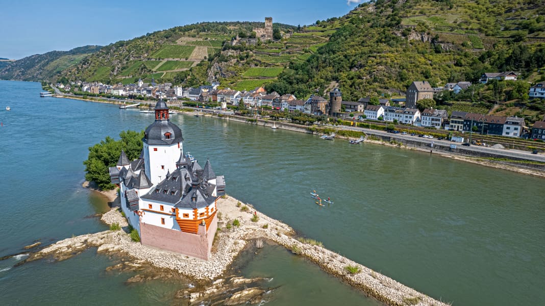
At river kilometre 544.4, the Rhine splits at the island of Kauber Werth. We take the right-hand course of the river away from the shipping traffic. The next highlight and popular photo motif comes into view: Pfalzgrafenstein Castle. The moated castle and fortification was built in 1326 by Ludwig the Bavarian to collect customs duties from passing ships. The castle, with its elongated hexagonal layout, can be visited and is therefore a worthwhile stop. The island in the middle of the Rhine is perfect for our break. A beautiful spot in the middle of the busy waterway!
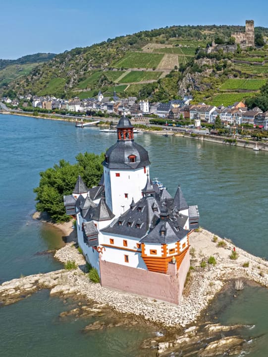
Directly behind the island, one of the many ferries crosses the Rhine. The ferry is just mooring on the bank - a favourable opportunity to end our break, pass the point and continue paddling. After the next right-hand bend in the Rhine at Oberwesel, the most striking and best-known site in the Middle Rhine Valley awaits: the Loreley. Many myths and legends surround the rock face, which became world-famous thanks to Heinrich Heine's Loreley Song. We paddle along the right bank and have a better view of the boats. The captains can also see us better. The Rhine becomes narrower and narrower and we pay more attention to the current, eddies and ships.
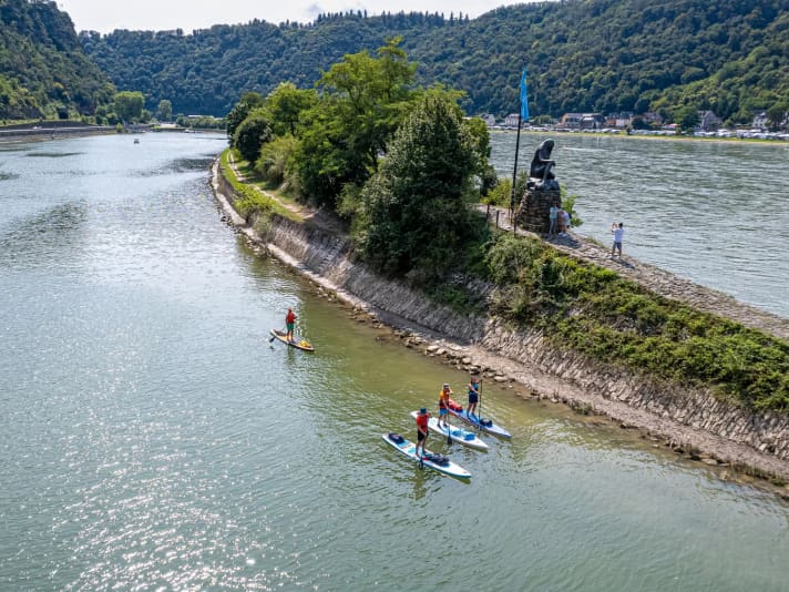
The 130 metre high rock face of the Loreley rises up on the right bank after the next left-hand bend. We are lucky that no large ship wants to pass through the narrow section during the minutes of our passage - the Rhine is only 113 metres wide at the Loreley. Not much room for boats and paddlers! Passing the Loreley sign, we come to the end of the harbour pier a good kilometre later and pass the bronze statue of the Loreley, which according to myth is also a mermaid on the rock. Directly behind it, we cross the navigation channel again and reach our destination for the day, St. Goar, on the left bank. We comfortably pull our boards out of the water at a staircase on the market square.
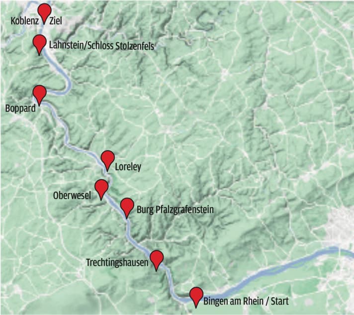
Second stage of the day to the Deutsches Eck in Koblenz
The next day, we continue at this point on the second day's stage to Koblenz - a good 36 kilometres lie ahead of us. We have a brief glimpse of Rheinfels Castle, one of the largest fortifications in Europe, but then have to watch out for the shipping traffic again. Some ships are waiting for clearance to pass through the Lorelei, others are quickly approaching downstream. Katz Castle and Maus Castle on the opposite bank are the last cultural highlights for a few kilometres. The Rhine becomes noticeably wider and the flow speed decreases. Compared to the previous day, we have to paddle much more. At one point, an overturning wave from a cargo ship builds up in front of us. We stop - and stay dry. We take our first break near Boppard. If you want to explore the town, it's best to use the ramp in front of the town centre.
After Boppard, we paddle through the largest loop of the Rhine, which is also home to Bopparder Hamm, the largest contiguous wine-growing area on the Middle Rhine. After the left-hand bend at Spay, we are already approaching Koblenz. First, however, the banks of Lahnstein pass us by. Stolzenfels Castle, an important Prussian building with its ochre-yellow colour, is visible from afar on the left bank. A few paddle strokes later, the Lahn flows into the Rhine on the right. We paddle along the right bank of the Rhine through the first districts of Koblenz. From the second Rhine bridge at Rhine kilometre 590 at the latest, we need to increase our attention again - the city centre and the moorings for the river cruise and excursion boats are getting closer. The signs indicate that we have to use the middle bridge opening, upstream boats use the outer two openings - a strange feeling as a small paddler in the middle of the big boats. The water becomes choppier and more turbulent.
We leave the Electoral Palace on the left and catch sight of Ehrenbreitstein Fortress on the hill. It was built between 1817 and 1828 and is the second largest preserved fortress in Europe. The cable car cabins that connect Koblenz city centre with the fortress hover above us.
The last highlight and the northern end of the Middle Rhine Valley awaits us: the Deutsches Eck, where the Rhine and Moselle rivers meet. Today, the equestrian statue of Kaiser Wilhelm I stands there as a monumental memorial.
At a favourable moment, we cross the Rhine and paddle into the Moselle. On the left bank, directly behind the Deutsches Eck, below the Königsbach beer garden, a narrow ramp offers a good exit. Koblenz railway station is around 1.5 kilometres away. We strap the boardbags on our backs and set off on foot.
A fascinating multi-day tour in fantastic weather - with wonderful impressions and moments that got the adrenalin pumping - lies behind us.
