"Have you been paddling on the Wörnitz yet?" I asked Stephan last summer over a cold drink in the beer garden. "No" was his short answer. But he became curious and wanted to know more: "You know rivers that I've never heard of. Is there anything exciting to discover there?" In response, I suggested that we simply go on a nice late summer trip with a few friends on the Franconian-Swabian river and let ourselves be surprised. No sooner said than done! On a beautiful autumn day, we set off for Bavarian Swabia, north of Donauwörth to be precise.
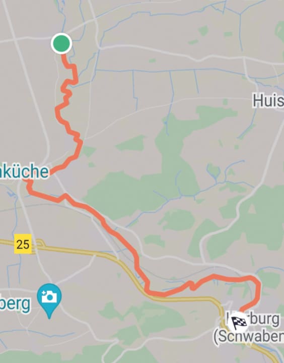
Meeting point: Harburg in Swabia - our later destination. There, the Wörnitz has already travelled around 120 kilometres from its source in Schillingsfürst in Franconia. And only 13 kilometres to the mouth of the Danube. Here we also find a car park for one vehicle directly at the later exit point for 0.30 euros/day at the weekend - how sweet.
The Wörnitz is also suitable for SUP beginners and families
According to tradition, the Wörnitz got its name from the Celts. They called the river Warantia, which means "the bending one". And we will find out why the Celts were spot on with their choice of name on our 13 kilometre tour, which has no major obstacles or dangers. It is therefore also ideal for river tour beginners and SUP-enthusiastic families.
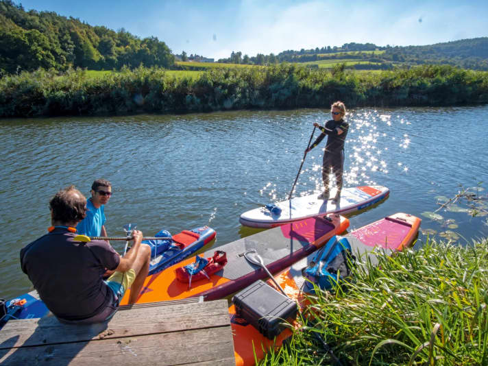
Our tour starts in the small, picturesque village of Wörnitzostheim. We find a car park right by the bridge over the Wörnitz. Where is the best place to start here? Not so easy, as there are no officially signposted entry and exit points. Directly by the bridge, a steep but easily accessible and paved slope leads down to the river. It's wide enough for us to get down with our inflatable touring boards. Once we've found the entrance, it's time to pump, pump, pump. We put short river fins into the boards - these are urgently needed here. The Wörnitz is extremely shallow in some places, especially in the first few kilometres. Just how shallow will become clear in a moment.
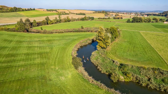
We paddle off and find ourselves in the middle of a beautiful natural oasis in the Nördlinger Ries. Here, the balance between man and nature is still in order. No noise, no hustle and bustle, green countryside. The Wörnitz meanders southwards for the first few kilometres. However, we don't notice much of the wide open spaces. The lower-lying Wörnitz and the lush green slopes block the view. At one point, it becomes so shallow that we have to get off our boards briefly and lift them over the shallows.
New discoveries around every bend
The landscape was shaped by a huge meteorite impact around 15 million years ago. An asteroid about one kilometre in size and a 150-metre satellite hit the earth here at over 70,000 km/h. An incredible impact. An incredible force. Rock was hurled out of the crater and formed large masses of debris on the crater rim. A lake of around 400 square kilometres was formed in the crater, which silted up after around two million years. Today's Nördlinger Ries was formed. The crater, with a diameter of a good 25 kilometres, is one of the best-preserved impact craters of its kind in the world. If you have time before or after the tour, you can find out more at the Geopark Information Centre in Nördlingen. Information boards throughout the Ries region also explain the history of its formation.
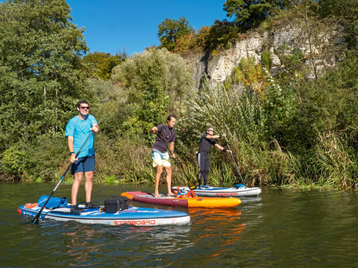
We continue to paddle relaxed through the natural riverbed and wait for new discoveries around each of the numerous bends. Birds chirp, butterflies and dragonflies circle around us. And the odd fish swims around under our boards. On this beautiful late summer's day, we are the only paddlers on the Wörnitz. This allows us to enjoy nature even more intensively and without stress.
The Wörnitz is a slow river
The Wörnitz only really flows in a few places. No wonder, as it is the slowest tributary to the Danube. This allows us to paddle at a leisurely pace and take a look at the houses in the village of Schrattenhofen, which pass by after around three kilometres.
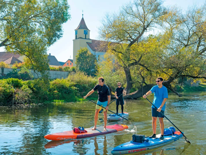
After a short, straight stretch with a small, fun rapids, the village of Heroldingen comes into view, which the Wörnitz runs right past. The Protestant St Martin's Church, which stands directly on the riverbank, offers a beautiful photo opportunity. The Wörnitz then makes a large bend around Heroldingen. Having initially paddled from north to south, we continue south-eastwards after the bend. We paddle past the mouth of the Eger, which feeds the Wörnitz with additional water from the right. We slowly approach the eastern end of the Ries basin. The landscape becomes more hilly. And so we see a predominantly bare hill - the Rollenberg. The summit plateau is surrounded by a ring wall. On the basis of findings there, researchers assume that there must once have been a cremation site.
At Rollenberg, near a small settlement, the next small rapids are waiting to be mastered. After another kilometre of paddling, a wooden bridge near Hoppingen blocks the continuation of the journey. The bridge is too low to pass underneath, and the steel cables make it difficult to get down onto the bridge. We have to unpack our acrobatic skills and climb onto the bridge between the cables. We push our SUPs under the bridge with a push. We take the opportunity for a short food and drink break. More than seven kilometres have been completed at this point.
The bends become fewer, the Wörnitz flows mainly straight ahead in a narrow valley in this section. We cross under the railway bridge and paddle straight towards the next village after a striking and tight S-bend: Ronheim. The small pedestrian bridge is no obstacle this time and we paddle under it without any problems. We take another short break for a drink before tackling the last two kilometres or so. Shortly after Ronheim, we pass under another railway bridge with striking pillars.
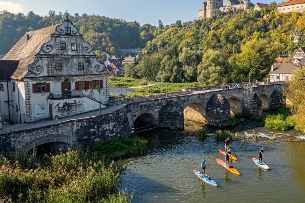
The old stone bridge in Harburg as a picturesque gateway
Directly behind it, the Wörnitz makes one last major change of direction. In a wide curve and with a 180-degree bend, the river seeks its way through the edge of the Nördlinger Ries. On the outside of the bend, a striking rock face can be recognised on the former Wörnitz impact slope. Today, the Wörnitz flows much deeper and probably more calmly along it.
We paddle under the third and last railway bridge. And then it towers directly in front of us: the Harburg, which gives its name to the city at its feet. Definitely the highlight of the tour. And on the last few metres. The reward, so to speak. It attracts our attention. At the end of the 13th century, the former Hohenstaufen imperial castle came into the possession of the Counts and later Princes of Oettingen. Today, Harburg Castle belongs to the non-profit Prince of Oettingen-Wallerstein Cultural Foundation. Almost 900 years of castle history can be discovered on a tour, which is absolutely worthwhile. The gates and towers befitting a castle can be visited as well as prison cells, embrasures and the church. The splendid banqueting halls provide an insight into life in a stately castle. Harburg Castle is one of the oldest and best-preserved castle complexes in southern Germany.
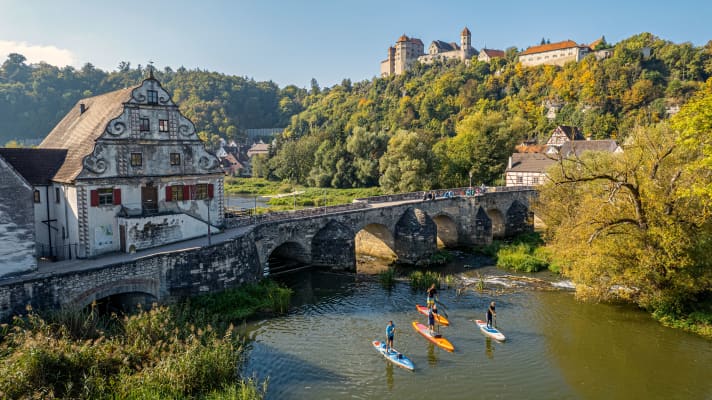
We paddle towards the centre of Harburg. Before the old stone bridge, the Wörnitz splits into two larger rivers. A weir directly under the bridge prevents us from continuing our journey. We decide in favour of the left branch of the river. A few more metres and we have reached our destination. First we take a look at the old Bruckmühle - a slightly dilapidated building at the start of the bridge. We all agree that the building would benefit from renovation. A small jetty in front of a reed bed is the perfect place to land and end the tour. "Have I promised too much," I ask Stephan as we high-five. "No! That was a great tour. Full of variety. Close to nature. And the view of Harburg: unique." Phew. A load off my mind. Everything done right - the best ideas thrive in the beer garden!
Information about the SUP tour on the Wörnitz
This article first appeared in SUP 2/2022
