How did you get into meteorology?
I studied meteorology and geography at the University of Munich and then worked in climate research for seven years. This is extremely important today, because once you've worked in climate research, you're in a position to evaluate things like the lively and controversial debate about climate change with sufficient critical distance. But my hobby has always been weather forecasting, the weather in general - and extreme weather in particular. I came to Bayerischer Rundfunk via private radio - first just for radio and then a little later for the television weather report. At that time, I founded the private weather service "WetterService Dr Sachweh". At that time I also did some articles for surf magazine and a wind forecast that could be called up by fax. Franz Schlittenbauer, the founder of the tour operator Surf & Action Company, then hired me to prepare reports for various spots around the world. He was the scout for new spots.
You specialise in maritime meteorology, which is rather unusual for a Bavarian. What draws you to the sea?
That's right, I've written a total of four books on maritime weather. They were published by Delius Klasing Verlag. I'm actually still missing a weather book for surfers - I'm still thinking about whether I should do that. My father is a passionate sailor and always took the family on sailing trips. That's how I discovered sailing for myself and my passion for (extreme) weather grew from the often intense weather experiences on board. We lived in Cologne and were on the water in Holland. In 1997, I sailed to the Caribbean with my father in the ACR regatta - a regatta for cruisers across the Atlantic. My father used his retirement to take his sailing boat to the Caribbean - and then lived on the boat for a few years. It was a great experience for me and I realised that not all trade winds are the same and that the trade winds in the east are very different to those in the west in the Caribbean.
How can you imagine the creation of a weather report?
Nowadays, some of the most powerful computers in the world are used for weather reports. It is important to realise that the atmosphere is a so-called chaotic system: a huge number of factors interact with and against each other - everything is very difficult to predict. You need a lot of data on the current state of the weather from as many points in the world as possible (not only from the stations on the ground, but also in the air). The computer is fed with this current data. It knows all the meteorological equations and can calculate the weather in the future from the current weather. The fact that the current weather conditions are so important for the forecasts is something we have experienced in the coronavirus era. The fact that 80 to 90 per cent of aircraft were on the ground meant that a lot of data was missing for the calculations. Every aircraft has sensors for temperature, air pressure and wind speed and constantly transmits the values to the German Weather Service. The fact that significantly less data was available due to the flight cancellations actually reduced the quality of the forecasts.
But you also make predictions for very local areas, including major events.
I had the honour of being the meteorologist for the European Athletics Championships in Munich. But I also provide my short-term forecasts for the organisers of major concerts, such as Robbie Williams or Helene Fischer, so that they can decide whether to issue warnings or cancel events. I use rain radar tools like the one from Wetteronline, but also special radar information that is not freely accessible. For another job with the Rosenheim hail pilots, I use a very precise tool called Konrad. For the rain radar, radar stations are networked at a distance of 200 to 300 kilometres and can detect rain, hail or even snow by reflecting their beams.
What are the Rosenheim hail pilots doing?
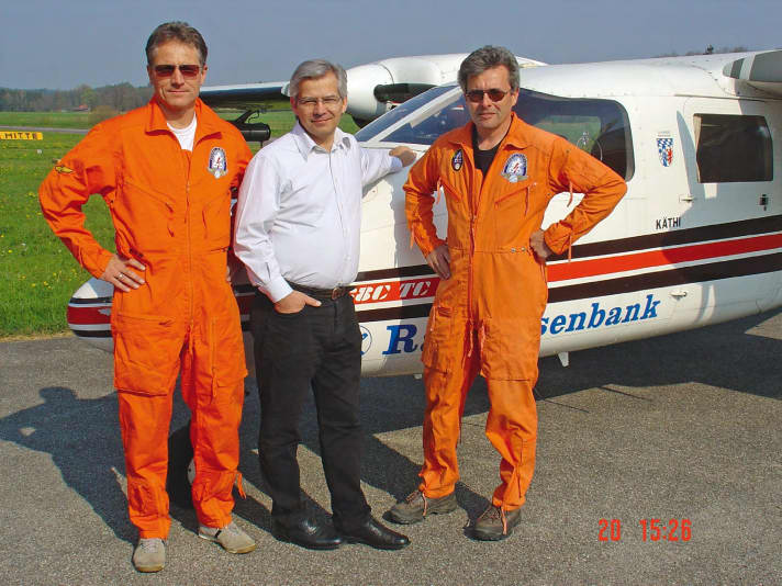
They have been around since the 1970s. They are financed by farmers, but above all by car manufacturers who have parked their new vehicles in open spaces. They can expect major damage if the hail is really large, i.e. thicker than two to three centimetres. If thunderstorms with hail are expected, I put the planes on alert in the morning. But only in the afternoon is it possible to say with any degree of reliability where thunderstorm cells will actually develop and where there is a risk of heavy hail. Then I send the planes out - and they "inoculate" the storm clouds with silver iodide. It is important to do this before the thunderstorm is in full swing. The silver iodide then has the effect that although the hail may be heavier, the grains are smaller and therefore do not cause any damage.

Is there any scientific proof that the wind has changed in recent years?
The changes in the past can certainly be proven by scientific studies. Looking into the future - i.e. how the wind will change - is not so easy in my view. The wind trends of the past have mainly been analysed by the wind energy industry, as it is naturally very interested in the development of the wind. And this shows that the wind in Central Europe has become weaker. This study is very reliable as it covers a period of more than 30 years.
But there are also exceptions. For example, it has not become weaker in the Baltic Sea, but has actually tended to become somewhat stronger. And the wind has also increased in the western Mediterranean. The wind has also become stronger in tropical regions, especially in South Africa around Cape Town. However, there is also a study that looks at the future wind trend in a warmer climate. Although this study confirms the general trend of decreasing winds over Central Europe, it has three interesting exceptions for us: Winds in the Baltic Sea, for example, are expected to continue to strengthen. The Meltemi in the Mediterranean is also expected to increase - and the windy area around Tarifa is also expected to be even better ventilated.

Is there an explanation for the increase in wind in the Baltic Sea?
The survey says nothing about which direction the wind is coming from. So it could be easterly winds, but also more northerly winds. These could be explained as follows: It is known that the Azores High is extending further and further towards us, which also explains the general decrease in wind in Central Europe. But a high cannot extend indefinitely, it encounters resistance somewhere. In our case, this seems to be the low pressure over northern Scandinavia and the Baltic states. And the Baltic Sea lies in the gap between the expanding Azores high and the low pressure bulwark over the Baltic - and this could explain the forecast increase in wind there.
The Azores High is partly responsible for the trade winds on the Canary Islands. Does the change in the high also affect the wind there?
If we assume that the Azores High will shift further in our direction, then the position of the core will also change. This would weaken the strong pressure gradient that is responsible for the trade winds on the Canary Islands. This would also mean a decrease in the wind there. But I take a very critical view of such forecasts, even as a climate researcher. Today, we are not even able to reliably predict the weather for a period of more than 14 days. So how are we supposed to be able to look that far into the future? At the moment, everyone wants to know whether there will be a mild winter and whether we will get through the energy crisis so well. There are actually forecasts that the winter will be a little too mild. But I wouldn't be surprised if we were hit by a freezing cold snap instead. Because it is often the case that after several mild winters, the pendulum swings in the other direction. The global warming trend should not be thought of as a straight line of rising temperatures. There is more of a wave movement, with downward swings.
In general, the wind is weakening in Central Europe. But there are also exceptions - for example the Baltic Sea.
But we also face the dangers of extreme weather. Is the weather really becoming more extreme?
When it comes to extreme weather, we always have dramatic images of storms, tornadoes, hail or flood disasters in front of our eyes. For me, however, the most dangerous development is the accumulation of heatwaves, of which we have had several in Germany in recent years. This summer alone, more than 4,500 people, most of them elderly, have died as a result of heatwaves in Germany.
But we've also been seeing more tornadoes here recently. We've never seen that before, have we?
I am sceptical as to whether there is actually an accumulation of tornadoes here. They used to happen ten or 15 years ago. But today, everyone has a smartphone and can document them and post them on the internet. As a result, they are of course everywhere. On the other hand, I completely agree with the climate researchers who point out that a warmer atmosphere is able to absorb more water vapour. This potentially increases the risk of heavy rain and summer storms, including tornadoes. Recently, there was a whole series of tornadoes in northern France that caused a trail of devastation over 150 kilometres. This is due to the fact that the Mediterranean was warmer than average this year - and this warmth was conserved. Mediterranean, overheated air masses were sucked in by a low over France and met a cold air front there. This is where the tornadoes formed.
Tornadoes and extreme weather are not only your profession, but also a great hobby of yours. How did you get into it?
My father also sailed with us in windy weather. The initial spark for my passion was probably when we experienced a strong sirocco on the boat, which turned into a bora - and our boat had an enormous heel even without sails. Many people find that threatening - I was quite different.
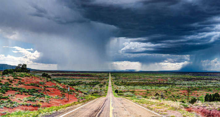
I also shared this characteristic with some colleagues in Upper Bavaria, where we often have strong thunderstorms. This gave rise to a real passion - and just as strong wind surfers may have their Mecca in Tarifa or Karpathos, for storm chasers it is Tornado Alley in Oklahoma, Kansas, Nebraska and Colorado. We fly there in May and June at the height of the tornado season and drive more than 10,000 kilometres through eight or nine states for three weeks. The thunderstorms lead the way and we don't know in the morning where we'll end up in the evening. It's a crazy road trip. In 2016, I published my adventurous experiences in the illustrated book "Stormchasing" published by Delius Klasing Verlag.

Can we imagine you as a wild horde of daredevils?
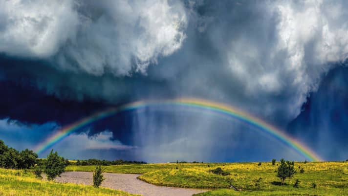
No, absolutely not. We don't want to be lumped together with sensationalist reporters. We are all meteorologists, including some experts from the severe weather warning service of the German Weather Service. And our aim is to use our tools to predict the development and path of thunderstorms and tornadoes. We don't want to chase the storms with our tongues hanging out. We want to be there before they arrive so that we have a front row seat to experience them and accompany them photographically and on film. That's more than just a hobby, it's a real passion - we're very similar to surfers in that respect.
Thank you very much for the interview and for contributing to this special. You can find Michael's storm experiences on YouTube under "Michael Sachweh". A calendar with many spectacular and excitingly described extreme weather photos by Michael will be published in summer 2023 in the Delius Klasing Publishing House (Planned title: "Weather Phenomena 2024").
All parts of the wind special:
- The west wind
- The east wind on the Baltic Sea
- Ora and Vento on Lake Garda
- The foehn in the Alps
- The Meltemi in Greece
- The bora in Croatia
- The sirocco in the central Mediterranean
- The mistral in the south of France
- The Tramontana in the northern Mediterranean
- The Levante in southern Spain
- The trade wind zone
- The roots of the trade winds
- Core trade wind - In the centre of the trade wind
- Passat run-off zone - The end of the Passat
- Interview: Climate researcher Dr Michael Sachweh - "Chasing storms is my passion"
- Windfinder: How wind forecasts are created, the difference between forecast and super-forecast


