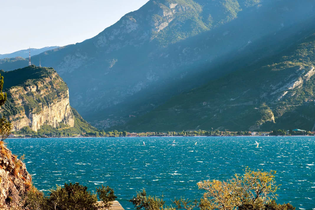
Surfing on a lake surrounded by high mountains? That can only end in a flaut disaster! That's what the layman and the uninitiated think. In reality, Lake Garda in northern Italy offers surfers an almost perfect portfolio of reliable winds suitable for planing. The secret of the wind engine of this popular water body on the edge of the Alps lies in its location between the northern Po Valley and the southern Alps, its north-south orientation and a channelling effect. On the neighbouring lakes, on the other hand, the winds are rather meagre and not all that reliable.
Situated at the interface between the plain and the mountains, Lake Garda benefits from thermal winds that are typical of lakes on the edge of the Alps and in the foothills of the Alps in fine weather.
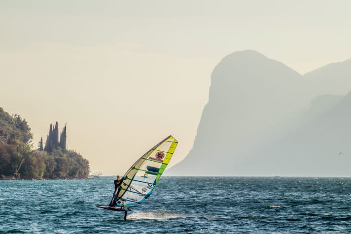
In the cooler part of the day, the cold air from the Central Alps flows towards the Po Valley via north-south valleys. In the warmer part of the day, the reverse is true: the lower air pressure in the Central Alps draws the wind from the Po Valley towards itself.
Valleys running north-south are the perfect wind locks, including the valley of Lake Garda. Its thermal wind system is so reliable that the winds have their own names. Two of the best known are the Vento, called Pelèr in the language of the fishermen - this is the wind that comes from the mountains in the north. The south wind ora replaces the cool north in the warmer part of the day. The winds get their real kick (Venturi effect) from the tubular narrowing of the current cross-section in the northern section of the lake. This is the Eldorado of the alpine surfing scene.
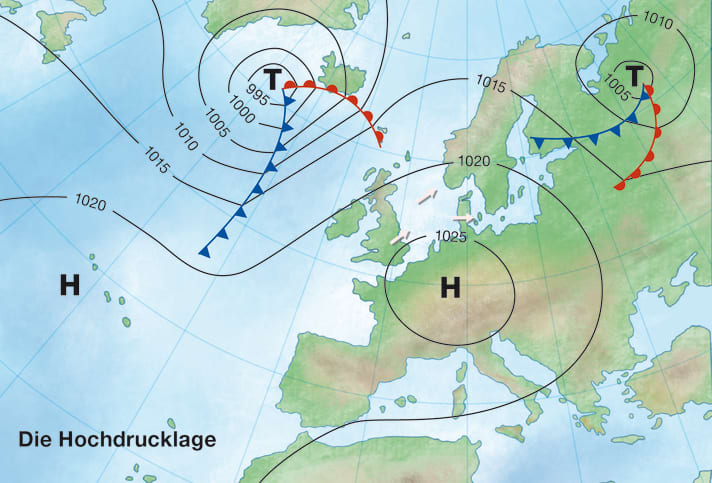
Typical weather map
Thermal wind systems such as the land-sea wind circulation and the mountain-valley wind circulation require weather with few clouds and a large-scale air flow that is as weak as possible in order to develop. In other words, the perfect large-scale weather situation for our Lake Garda winds is a high-pressure situation.
It makes a small difference where the centre of the high is located - and whether there is a very warm or rather cool air mass over the central and southern Alps. A centre of high pressure near the Central Alps or on the northern side of the Alps is ideal - and a cool to moderately warm, preferably not too overheated and quite dry air mass. This not only gives the Vento the right boost. At the same time, under these sunny conditions, the Ora also has a good chance of displacing the Vento later in the day and catching up with it in terms of gliding winds in the afternoon.
Area of action
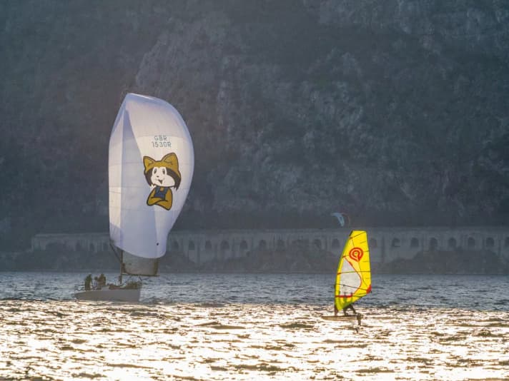
The classic Vento Ora area is the narrow, central and northern section of Lake Garda. Here, the thermal winds blow from the north-east or south-west and are very reliable and frequent thanks to the topographical canalisation - with gliding winds guaranteed, especially in the north between Malcesine and Riva on the northern shore.
Lake Garda widens to the south, roughly along a line from Isola del Garda (in the west) to the spur of Monte Lupia near San Vigilio (in the east). Here, the shore areas and their hinterland have more of a flatland character. This eliminates the Venturi speed factor, while at the same time other winds from the west or east also like to mix in. Here in the south, the winds are more erratic and generally weaker.
As is often the case with a large lake into which several mountain valleys flow, the locals on Lake Garda are also familiar with a number of other winds. In the north-west corner of the lake, near Riva, there are sometimes cool and sometimes gale-force gusts from the direction of the Ballino Pass after thunderstorms or cold spells in the mountains - this is the Balinot.
Particularly in the north of the lake, and here especially on the eastern shore, night-time or morning montes blow out of gorges and valleys - they are localised, usually only weak, and rarely reach the opposite shore of Lake Garda. Similarly, during the day, when the Vento and Ora are weak or the current is just capsizing, there are local onshore sea breezes, such as the Gardesana, which relieves the midday heat in the shore area between Garda and Sirmione.
High season
From May to September, Vento and Ora show up particularly often when the high pressure is calm, while the Ora is in peak season from May to July. During this time, the sun develops its strongest warming power and the suction effect of the Alpine heat low is maximised. The Ora engine then runs like clockwork and at full speed.
There are only so many surf schools in such a small area in the north of Lake Garda.
The Vento is also most reliable in the summer months, but unlike the Ora, it is sometimes also very good in April or September. This depends on various factors: A cold spell of air in the central Alps preceding the high pressure situation strengthens the Vento, especially at the beginning of the high pressure situation. Times with a low snow line, as is typical in spring, can also be a real adrenaline rush for the north wind.
Ora and Vento - reliable but sensitive
The northern part of Lake Garda is blessed by its location: Both the cold mountain air from the north and the warm air masses from the south are accelerated between the mountain flanks to the west and east. For the system to work, it needs a stable area of high pressure.
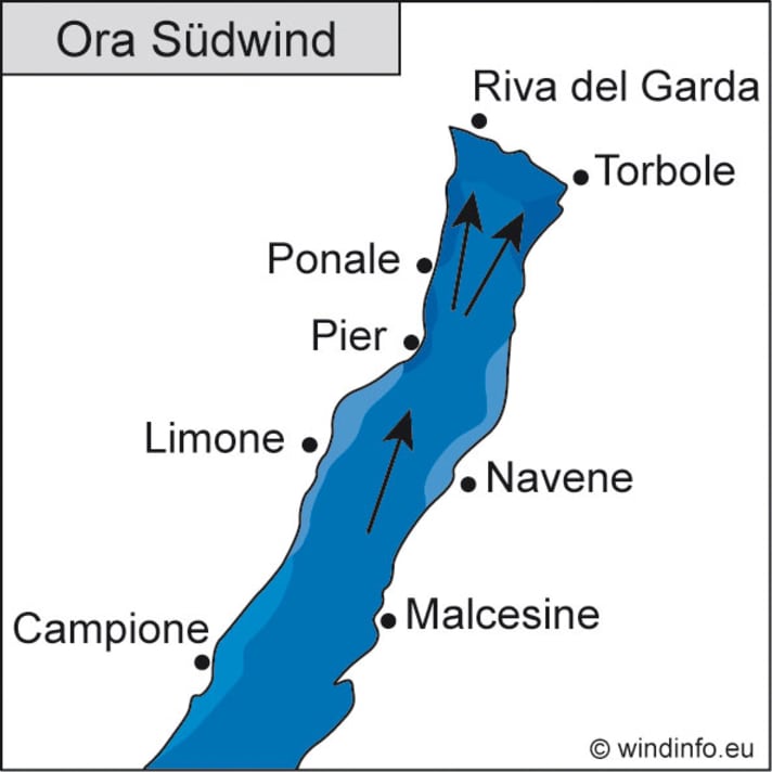
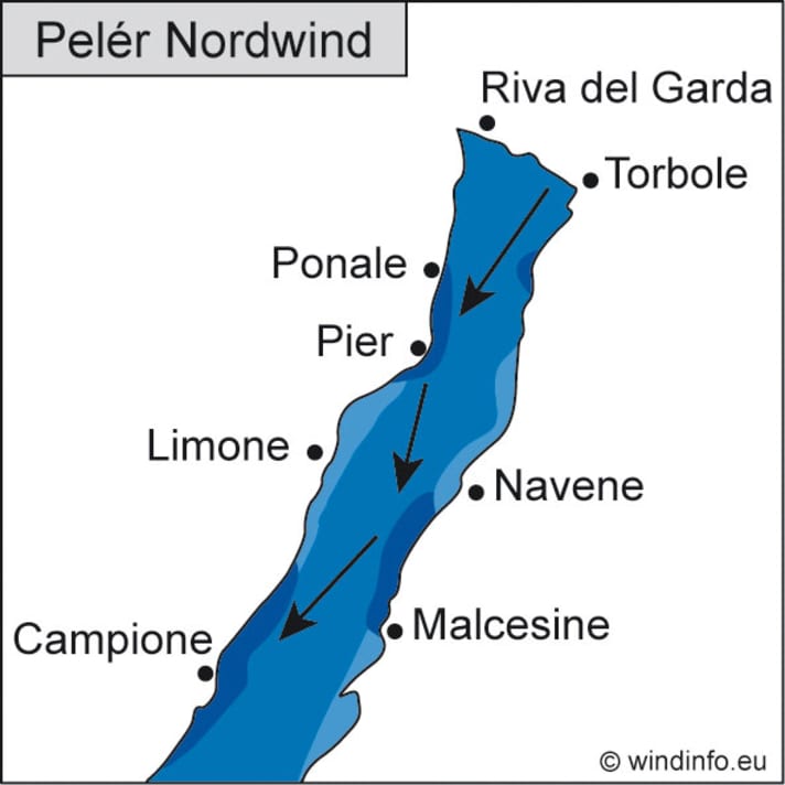
Typical wind and weather conditions
During the night, cold air collects in the Alpine valleys, which then flows down the valleys as a so-called mountain wind due to the higher specific weight of the air mass. Several cold air flows from Trentino reach the shore areas in the far north of Lake Garda and merge there to form the Vento: the mountain winds of the Ledro Valley, the Varone Valley and the Sarca Valley above Torbole.
The Vento usually starts in the second half of the night in the northern bay of Lake Garda and conquers large areas of northern Lake Garda as a rather gusty north-north-easterly wind, reaching its greatest strength at sunrise and increasingly reaching the south of the lake. Typical wind speeds between Riva and the centre of the lake at the height of Torri del Benaco are three to four, sometimes five Beaufort - in the south it rarely reaches gliding wind quality, there it is usually only two to three Beaufort. Towards midday, it gradually dies down, first in the south and later also in the north of Lake Garda. While the Vento is blowing, it is relatively cool in clear air.
At midday, the air current capsizes, the wind then becomes temporarily weak and local onshore sea breezes get their chance.
In the afternoon, the Ora begins to conquer the lake from the south. This wind from the south to south-west carries the warmth of the Po Valley to the spots. Its character differs fundamentally from the Vento. The Ora blows quite steadily without any particular gusts and is generally weaker than the Vento at two to four Beaufort. Like the north wind, the south wind also reaches its greatest strength between the towering mountains in the north of Lake Garda thanks to the Venturi effect. A constant gliding wind then prevails there in the afternoon.
While the Ora is blowing, it is warm - sometimes humid and hazy in midsummer. A few cumulus clouds form over the mountains, but if the high pressure area is strong enough, they have no chance of developing into thunderstorms. In the course of the evening, the Ora gradually subsides and is usually no longer usable for surfing at sunset.

Amplification factors
The Vento gains momentum the colder it is in the mountains north of Lake Garda, where it originates. If it snows far down there and the snow remains, the cold air drainage towards Lake Garda takes place with great vigour. Naturally, this is most likely to happen at the beginning or towards the end of the surf season.
In summer, night-time rainfall in the central Alps acts as an effective cooling agent to turn the Vento into a strong wind.
However, the most effective speed factor for the Vento has proven to be a northern overflow of the Alps. While the northern side of the Alps is shrouded in clouds despite the high air pressure, the air in South Tyrol, Trentino and everywhere in northern Italy is crystal clear and the sky is deep blue. This is because the north foehn blows here, giving the Vento a helping hand and giving it wings.
Locals are also very familiar with the numerous local peculiarities and reinforcements of the Vento. If the main direction of the Vento is north-north-west, then the main jet starts at Riva and aims for the eastern shore, where the mountain flanks give the Vento a huge additional kick at Navene and Malcesine (guard rail effect). A north-north-east Vento, on the other hand, whistles out onto the lake, especially in the shore area near Torbole. In this case, the locals head for the western shore, where the north gets its extra kick at the Reamol-Huk.
The afternoon Ora is not characterised by such pronounced speed factors as the Vento. It is particularly well developed when the centre of high pressure lies to the east of the lake in the direction of the Eastern Alps.
Sometimes the Ora blows strongest in the southern part of Lake Garda. This is the case in bora weather conditions, when a brisk easterly wind sweeps across the Po Valley and a branch of the current in the form of the Vinessa finds its way to southern Lake Garda. In such weather conditions, the surfers in the north of the lake have long faces as they wait in vain for a strong Ora. There, the Venturi effect only works with the classic Ora with a south to south-westerly current direction - for this south-easterly Ora, however, the mountain flanks there are not a speed factor, but an obstacle.
Disruptive factors
As reliable and sometimes lively as Vento and Ora are in summer: As part of a thermal mountain-valley wind circulation, they are a delicate little plant that can only thrive in an undisturbed high pressure situation. Low pressure systems that break into the Southern Alps from the west or north mean the end of Vento and Ora. The wind system is disrupted as soon as a low pressure system approaches. A front from the west is signalled, for example, by cloud thickening, an undercutting of the Vento and a temporary extension of the Ora phase. The south freshens up, especially in the southern part of Lake Garda, and turns to the south-west. This ora, which is no longer quite so genuine and precedes rainfall from the west, is called Ander.
A weak summer high pressure system with high humidity promotes the formation of localised heat storms in the mountains around Lake Garda. They have their own wind system and disrupt or end the Ora. In this way, a developing thunderstorm exerts a pull and the winds then move towards the young thunderstorm cell. At the peak of thunderstorm activity and afterwards, the cold air outflows from the rain determine the winds. The wind then comes from the direction of the strongest floods of rain, often very gusty and with strong wind or even storm potential.
All parts of the wind special:
- The west wind
- The east wind on the Baltic Sea
- Ora and Vento on Lake Garda
- The foehn in the Alps
- The Meltemi in Greece
- The bora in Croatia
- The sirocco in the central Mediterranean
- The mistral in the south of France
- The Tramontana in the northern Mediterranean
- The Levante in southern Spain
- The trade wind zone
- The roots of the trade winds
- Core trade wind - In the centre of the trade wind
- Passat run-off zone - The end of the Passat
- Interview: Climate researcher Dr Michael Sachweh - "Chasing storms is my passion"
- Windfinder: How wind forecasts are created, the difference between forecast and super-forecast
