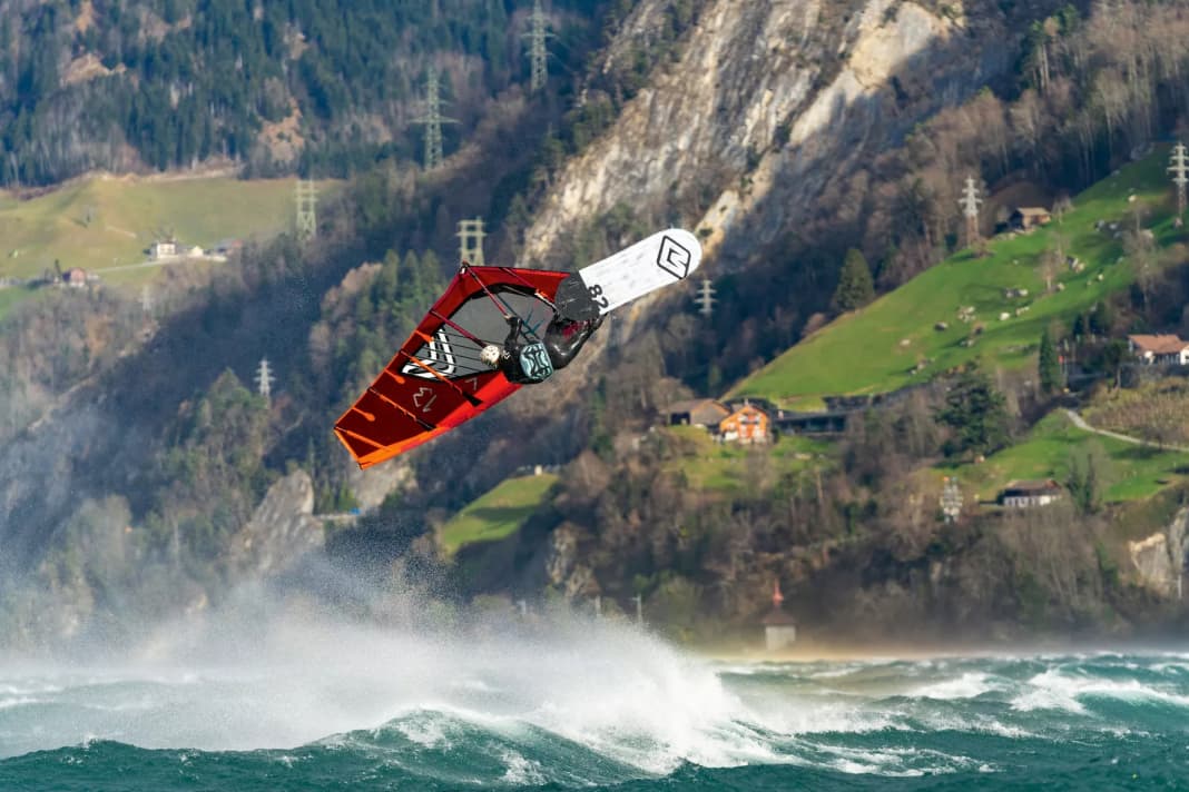
The ancient Romans in the Alpine region called an unusually mild wind coming down from the mountains Favonius. This gave rise to the name "Föhn", which stands for a warm downslope wind. We know this wind from the Alps, especially from the north side, where the valleys on the north side, including the Alpine foothills, experience an influx of dry and warm air during an overflow of the main ridge from the south - often accompanied by sunny weather and brisk winds (south foehn).
However, the original meaning of the word was "mild west wind". How did the ancient Latins come to speak of a westerly wind, you might ask? Did they perhaps not take the direction of the compass very seriously? In reality, however, their observation is probably correct. After all, the name for our foehn probably comes from Piedmont in northern Italy. Here, at the foot of the Western Alps, we not only benefit from the foothills of the northern foehn, but also have our own foehn. And it comes with the westerly winds - foehn producers are the Graian Alps, which are up to 4000 metres high, and the Maritime Alps.
Foehn develops on the lee side of mountains
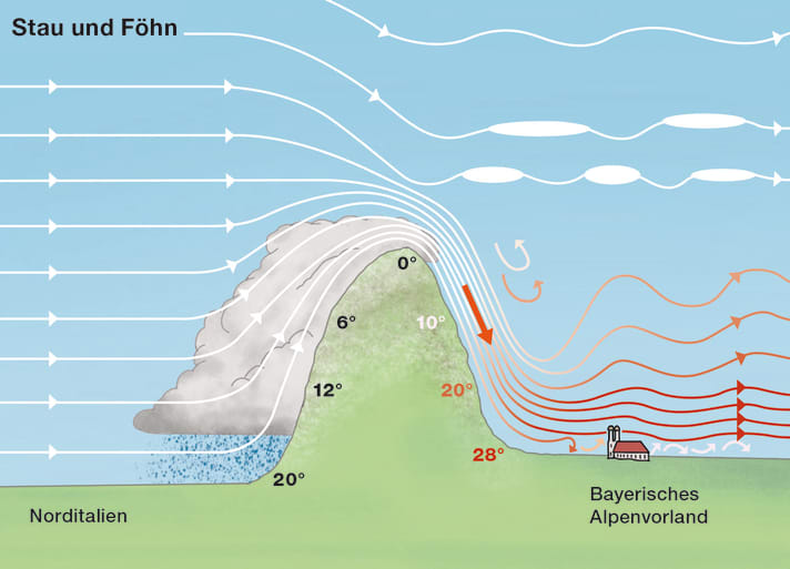
Föhn occurs on the leeward side of mountains when a lively current is directed towards the mountain range. For physical reasons, the air heats up considerably as it descends towards the valleys, in cloud-free areas even by a considerable one degree per hundred metres of descent. This process also disperses most of the clouds that have formed on the other side of the mountain due to the congestion of air masses.
The very gusty foehn wind, which often starts abruptly, is a challenge for water sports enthusiasts. Locals with their knowledge of the local weather are rarely in such demand as in foehn weather.
Typical weather map
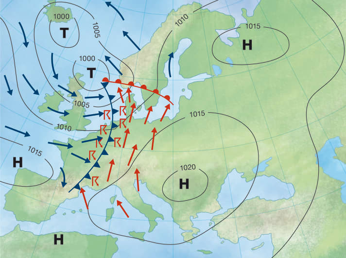
Let's take the example of the Föhn on the northern side of the Alps (southern foehn): The prerequisite for this is a southerly air flow in the three to four lowest thousand metres of the atmosphere. For this, we need low air pressure over Western Europe and higher air pressure towards the eastern edge of the Alps, with the low pressure prevailing here. A classic Föhn weather situation occurs when the cold front of an Atlantic low approaches the Alps from France. In the run-up to the front, winds often blow from the south to south-west. In this situation, the southern Alpine mountains are shrouded in clouds and it rains or snows for longer periods of time (accumulation weather situation). While the bad weather skies over the northern side of the Alps suddenly open up - and gusty southerly winds carry dry warmth into the valleys, even far into the Alpine foothills and their lakes.
Even with high pressure, a southerly foehn can occur if the centre of gravity of the high lies east of the Alps, so that a southerly air flow can establish itself on the western flank of the high. In contrast to the classic foehn, which is influenced by low pressure, the foehn is often limited to the lowest thousand to two thousand metres of the atmosphere. This so-called shallow foehn does not extend as far as the foothills of the Alps and is often limited to the valleys and lakes at the edge of the Alps.
Area of action
Contrary to popular belief, foehn weather does not only occur on the Swiss-German-Austrian northern side of the Alps, but everywhere on the leeward sides of the mountain ranges where the mountains are flooded.
In some regions, foehn weather conditions even characterise the vegetation due to their high frequency. The Argentinian Zonda foehn wind in the lee of the southern Andes is famous. The dominant westerly winds create dense rainforests on the Chilean side of the mountains and steppe landscapes on the Patagonian leeward side of the mountains.
There are also foehn variants in the Andes, the Rocky Mountains - and even in Norway.
The foehn in the North American Rocky Mountains can melt the snow in no time as a chinook. And in south-west Greenland, at the foot of the Greenlandic high plateau, it surprises with a sudden rise in temperature of up to 20 degrees when easterly winds set in!
Foehns are less frequent, but no less spectacular, in Central Europe. In pronounced north-westerly weather conditions, the Skanden, the mountains of Norway, bring the most beautiful weather to the beaches from the Skagerrak down to Rügen - thanks to the foehn effect (Skandenföhn). A southerly air current creates a foehn on the northern side of the Alps. More or less all spots north of the main Alpine ridge are affected by these southerly foehn episodes - from the lakes Lac du Bourget, Lac d'Annecy and Lake Geneva in the west to Lake Constance and the Bavarian lakes (such as Lake Starnberg and Lake Chiemsee) to the waters of Upper and Lower Austria in the far east - such as Lake Traunsee and Lake Erlaufsee.
High season
Looking at our northern Alpine lakes, foehn is possible all year round. As the air pressure gradient is the main motor of the foehn jet and the foehn is often triggered by distinctive low pressure systems approaching from the west, foehns occur particularly often in the more changeable half of the year - i.e. from October to April.
The months of October and November as well as March and April are the peak season for the foehn. Foehn weather conditions also occur relatively frequently in winter, but thick lakes of cold air in the valleys and over the Alpine foothills often prevent the warm downslope wind from breaking through down to the spot.
Typical wind and weather conditions
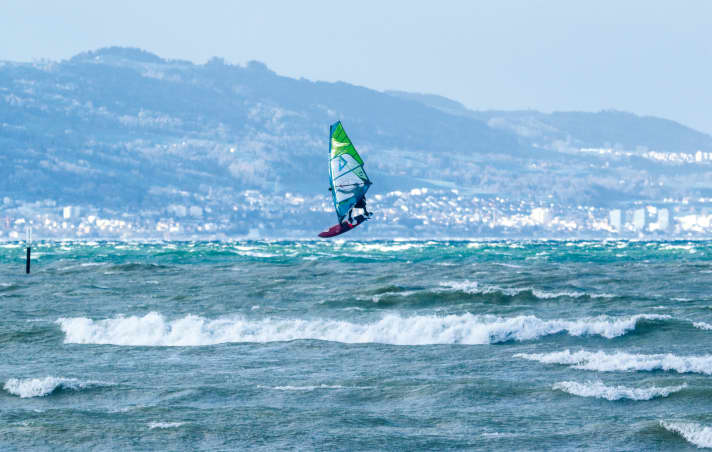
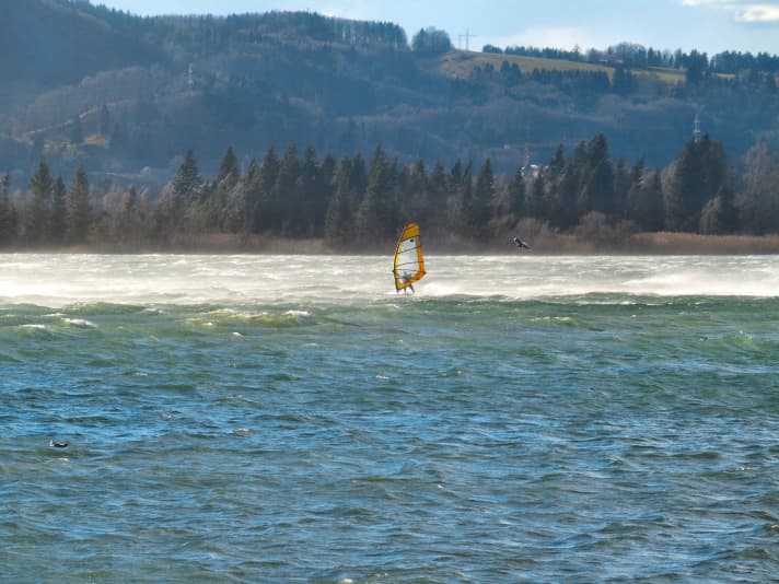
As befits a downslope wind, the foehn comes in surprisingly abruptly - similar to the bora. However, while its Adriatic counterpart is considered a cold downslope wind and is perceived as cool there (compared to the normal warmth of the Adriatic air), the foehn pushes temperatures up - and often quite abruptly. On Lake Kochel in Upper Bavaria, for example, the mercury soars when a strong Föhn wind sets in. A veritable heat surge from ten to 20 degrees within 30 minutes is not uncommon there. Typical of downslope winds, the gusts arrive suddenly at the spot. There are hardly any warning signs of the gusts - apart from the trees suddenly bending on the southern shore of the lake and whitecaps appearing on the water. And when it hits hard, the water, which was calm a minute ago, lifts into the air as a long plume of spray. So the foehn is an attack out of nowhere.
The foehn blows over the lakes in the Alpine foothills without warning.
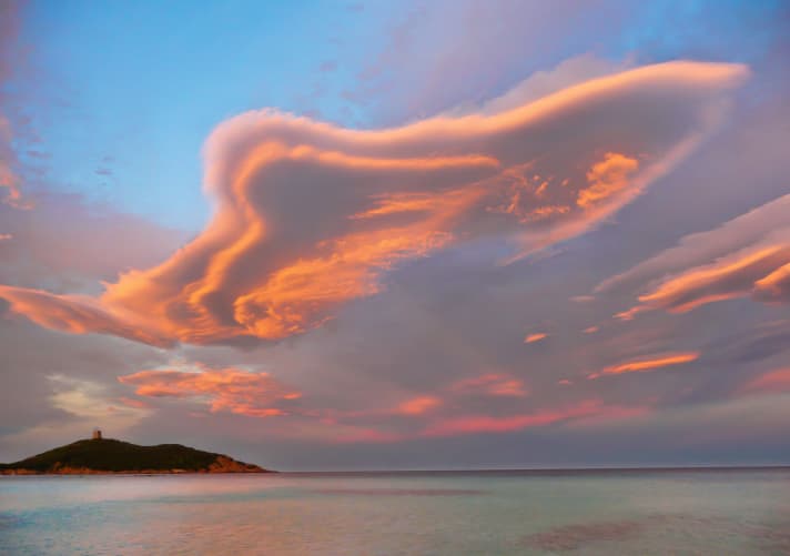
The only warning sign that immediately precedes the gusts is a rapid rise in temperature. The fact that a foehn weather situation generally prevails can often be clearly recognised in the sky: Despite low air pressure, the sky is predominantly blue with good visibility (or at most a few, high cloud fields are visible). Foehns are characterised by scattered, often very strange-looking clouds that are quite thin and have a sharp outline that separates them from the cloud-free space. With their shape, they resemble flatfish or lenticulars, which is why they are also known as "Altocumulus lenticularis" in technical jargon. These clouds are recognised worldwide as a reliable sign of downdrafts - whether in the Argentinian pampas at the foot of the Andes or in the Alpine foehn.
A foehn episode on the northern edge of the Alps rarely lasts longer than one or two days in summer, but from autumn to spring it can be foehny for three or four days in a row.
Our south foehn often disappears just as abruptly as it once appeared at the spot. The wind then usually turns to the west, sometimes accompanied by rainfall, which can also bring quite heavy thunderstorms from May to September.
Amplification factors
The greater the air pressure gradient and thus the flow over the mountains, the stronger the foehn. The difference in air pressure between Bolzano and Innsbruck is used as a rule of thumb for the Föhn in Tyrol and on the Bavarian edge of the Alps: If the pressure in Bolzano is at least four hectopascals (hPa) higher than in Innsbruck, you can expect a foehn. With a difference of 8 hPa and more, things get violent - with squalls in the Foehn valleys and a Foehn that extends far beyond the Munich area, sometimes as far as the Danube. In addition to the pressure gradient, the topographical location of the spot is at least as decisive for the strength of the foehn. The following applies:
- The closer to the edge of the Alps, the stronger and more frequent the Föhn winds are able to break through (right down to the lower altitudes of the valleys and the Alpine foothills with the lakes).
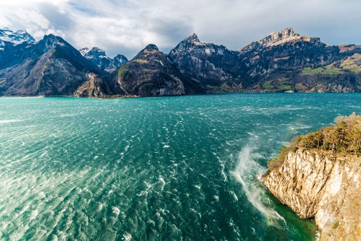
- It can get really stormy in the valleys on the edge of the Alps and in the Alps if the orientation of the valley roughly corresponds to the direction of overflow of the Alps. For example, the north-south orientated part of the Swiss Lake Lucerne between Ingenbohl and Flüelen (where the Reuss valley flows into the lake) is a notorious foehn jet, with a purely southerly overflow of the Alps. On Lake Constance, the south-eastern shore - for example between Bregenz and Rorschach, where the wide Rhine valley flows into the lake - is particularly affected by Föhn storms when the wind blows from the south and south-west. For the same reason, strong foehn gusts are also known to occur on Lake Achensee in Tyrol, especially when the wind blows from the south to south-east.
Disruptive factors
Anything that reduces the air pressure gradient over the mountains that generates the Föhn also weakens the downslope wind. In the case of the southern Föhn in the northern Alps, this can be caused by a weakening of the western European low as well as a weakening of the high in the east. A look at the trend of the current air pressure values (is the pressure difference between Bolzano and Innsbruck decreasing?) in weather portals such as WetterOnline helps to assess the foehn trend.
A complete cessation of the Föhn situation, the so-called Föhn breakdown, is to be expected at the northern Alpine spots when the cold front of the Western European low reaches the spot from the west. This will be signalled by increasing cloud cover and later rainfall in the west of the spot. A look at the current weather reports and the weather radar helps to estimate the end of the foehn. Caution: In summer, foehn gusts and heavy thunderstorm gusts can join forces with the following front!
Hairdryer - warm powerhouse
This is what a classic foehn situation looks like on the weather map: Bad weather with lots of rain pushes against the southern Alps from the south. If the air then flows over the main Alpine ridge, it warms up strongly on the north side and rushes into the Alpine valleys as a downdraft - and into the Alpine foothills.
All parts of the wind special:
- The west wind
- The east wind on the Baltic Sea
- Ora and Vento on Lake Garda
- The foehn in the Alps
- The Meltemi in Greece
- The bora in Croatia
- The sirocco in the central Mediterranean
- The mistral in the south of France
- The Tramontana in the northern Mediterranean
- The Levante in southern Spain
- The trade wind zone
- The roots of the trade winds
- Core trade wind - In the centre of the trade wind
- Passat run-off zone - The end of the Passat
- Interview: Climate researcher Dr Michael Sachweh - "Chasing storms is my passion"
- Windfinder: How wind forecasts are created, the difference between forecast and super-forecast
